How Map Digitisation Changed the Way People Navigate Cities
Cities have always depended on maps. Long before smartphones, GPS, and live traffic overlays, urban life was shaped by printed guides, folded street plans, transit diagrams, and local knowledge passed from person to person. To move through a city was to interpret space through static information. A map showed roads, landmarks, and routes, but it could not adapt. It could not respond to congestion, suggest alternatives, track real-time movement, or recalculate based on changing conditions.
That limitation defined the experience of navigation for generations. Whether someone was walking through a park, driving across a city, or trying to find a station in an unfamiliar neighbourhood, the map was only as useful as the user’s ability to read it and translate it into action. In many ways, navigation was once as much about memory and interpretation as it was about information.
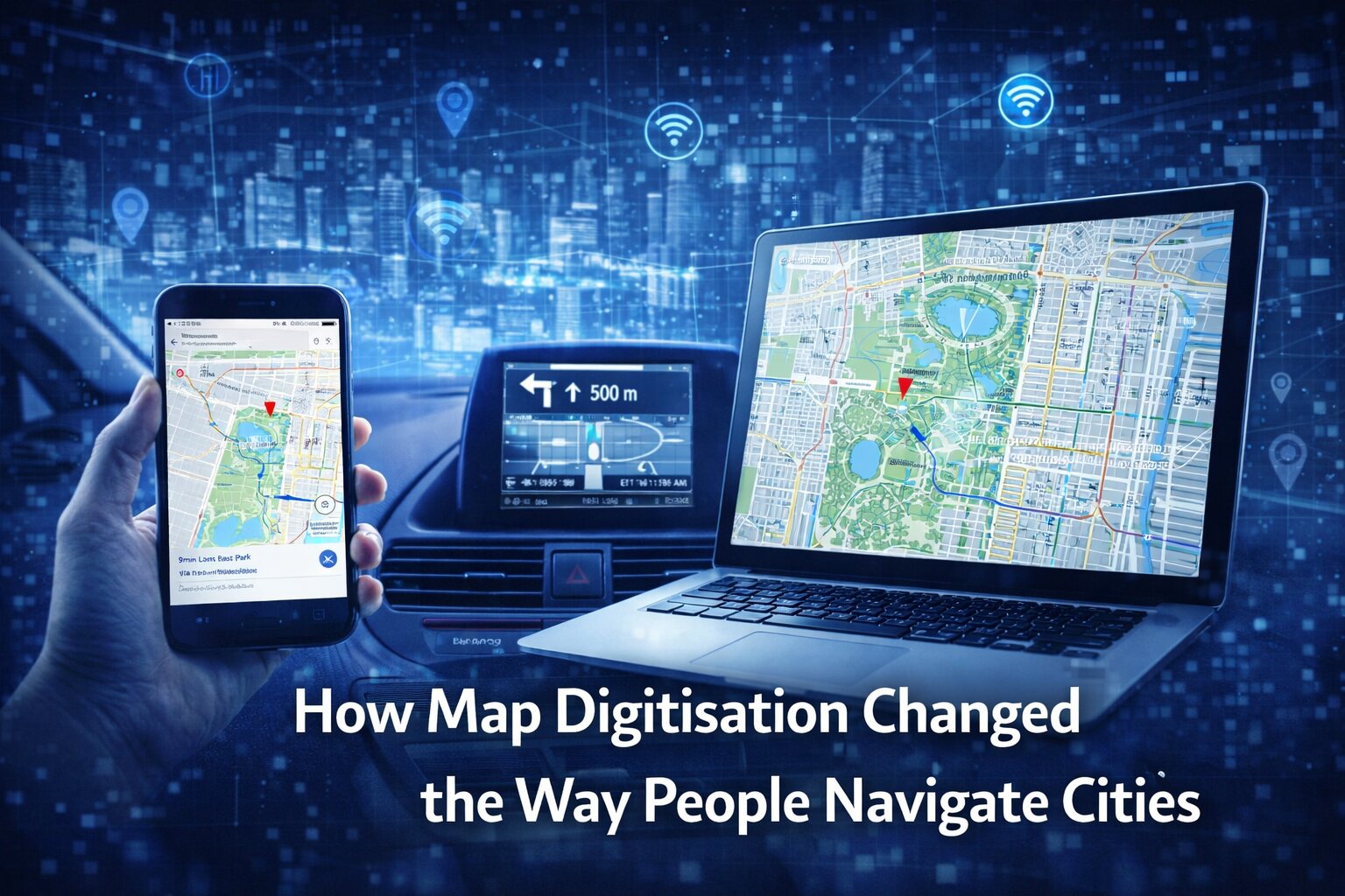
Map digitisation changed that completely. It did not just turn paper maps into screens. It transformed how people understand place, movement, distance, and urban space itself. As mapping became digital, interactive, and increasingly real-time, cities became easier to search, navigate, analyse, and experience. In the process, maps shifted from being passive references to becoming active systems—systems that now influence everything from commuting and tourism to logistics, urban planning, and personal privacy.
From fixed representation to dynamic information
For most of modern history, maps were fundamentally static. They represented a city at a specific moment, translated into a printed visual form that could be carried, pinned, or folded away. Even the best city maps (think about the great maps of Central Park, New York, for example) were limited by this fixed nature. Streets could change, businesses could close, transit routes could shift, and construction could alter movement patterns, yet the map itself remained unchanged until a new version was printed.
This meant that navigation depended on a combination of map-reading skill and contextual judgment. People often needed landmarks, verbal directions, prior familiarity, and local knowledge to supplement what the map showed. A printed map could tell someone where Central Park was, for example, or where a road ran across Manhattan, but it could not answer a more fluid question such as the quickest route right now, the least crowded entrance, or whether public transport disruption had changed the best path.
Digitisation altered the very nature of the map by making it updateable, searchable, and interactive. Once maps became data-driven systems rather than static images, they could respond to change. Roads could be reclassified, points of interest could be updated, and routes could be recalculated instantly. This created a new relationship between map and city. The map was no longer simply describing urban space; it was increasingly participating in how urban space was used.
The early stages of digital cartography
Map digitisation did not begin with consumer smartphones. Its roots lie in broader developments in computing, spatial data, and geographic information systems. As governments, researchers, planners, and businesses began converting geographic information into digital formats, maps started to shift from visual documents into structured data layers that could be edited and analysed computationally.
This was an important conceptual change. A digital map is not merely a scanned image of a paper one. It is often built from separate data layers that can represent roads, boundaries, land use, elevation, transport networks, building footprints, and countless other variables. Once geography becomes data, it becomes something that can be queried, sorted, combined, and reinterpreted.
That mattered first in specialist environments. Urban planners, engineers, and public agencies could model city infrastructure in ways that were difficult or impossible with paper records alone. But over time, the underlying principles of digital cartography moved into mainstream life. What began as a technical and institutional capability would eventually become one of the most familiar consumer technologies in the world.
Search changed navigation as much as the map itself
One of the most important changes introduced by digital maps was the ability to search. This may sound obvious now, but it represented a major break from the way people had previously used maps. On a paper map, a user often had to know roughly where something was before finding it. Street indexes and grids could help, but the process still depended on manual lookup and spatial interpretation.
Digital search changed that relationship entirely. A person no longer needed to begin with geographic understanding. They could start with a destination name, a category, or even a vague query. The map would not only locate the destination but also centre it, contextualise it, and often offer multiple ways to reach it.
This shifted maps from being primarily navigational aids to being discovery tools. Users began to interact with urban space through search logic. Restaurants, stations, museums, parks, offices, and landmarks became retrievable objects within a digital environment. The city was increasingly experienced not just as physical territory but as searchable information.
That transformation had broad implications. It changed tourism, local exploration, and commercial visibility. Businesses became more dependent on digital discoverability. Places that were once found through signage, reputation, or chance increasingly relied on being represented accurately and visibly within mapping platforms.
GPS and the real-time turn
Digitisation alone was transformative, but the integration of GPS made maps radically more personal and immediate. Once users could see their own position in real time, the map stopped being something external and became something relational. It was no longer just a representation of the city. It was a system that understood where the user was inside that city.
This mattered because it reduced one of the hardest parts of traditional navigation: self-location. Paper maps require users to identify themselves within the spatial representation. That can be difficult, especially in unfamiliar or visually repetitive urban environments. GPS reduced this burden dramatically. The map could now place the user, track movement, and adjust direction continuously.
That changed everyday behaviour. People became less reliant on pre-planning and more comfortable with on-the-go navigation. Walking in unfamiliar neighbourhoods, changing route mid-journey, finding nearby services, or exploring without preparation all became easier. Real-time positioning also made digital maps more useful not just for one-off trips, but for ordinary life. Navigation became continuous rather than exceptional. You’d seriously reduce your chances of getting list in New York.
Cities became layered environments
Another major effect of map digitisation was that it turned urban space into a layered environment. A paper map might show roads and landmarks, but a digital map can show far more: transit lines, live traffic, cycle routes, reviews, opening hours, photos, terrain, weather overlays, construction zones, and estimated travel times. Each of these layers changes how the city is perceived and navigated.
This layering matters because it means people no longer interact with the city only through physical cues. They also interact with it through data. A street is not just a street; it is potentially a route with traffic information, walking estimates, business visibility, and safety assumptions attached to it. A park is not only a green space; it is also a searchable destination, a reviewable location, a route network, and a geotagged experience.
Take a place like Central Park. Historically, a printed map of the park might help someone identify paths, entrances, and landmarks. A digital map can now go much further. It can help users find the nearest route from their current location, estimate walking time, identify transit links to nearby points, surface nearby attractions, and integrate the park into a broader city journey. That is not simply convenience. It is a different model of spatial experience.
The smartphone made maps ambient
The rise of the smartphone completed the shift from occasional navigation to ambient mapping. Before smartphones, even digital maps were often tied to desktops, printed directions, or dedicated navigation devices. They were tools used at particular moments. Smartphones turned them into a constant presence.
This changed not just access, but behaviour. Because maps were now always available, people no longer had to think of navigation as a separate task. They could consult directions mid-walk, reroute on public transport, search for nearby options while standing on a street, or spontaneously alter plans based on location and time. The map became woven into daily decision-making.
In practical terms, this reduced friction in urban movement. In cultural terms, it changed how cities were inhabited. Urban confidence increasingly depended less on memory and familiarity and more on interface access. A person could move through an unfamiliar city with a degree of assurance that would previously have required local experience or extensive preparation.
This did not make cities less complex, but it changed how complexity was managed. The smartphone map became a portable layer of interpretation always available in the user’s hand.
Tourism, local commerce, and the visibility economy
Map digitisation has had a major effect on how cities are consumed economically and culturally. Tourism, for example, has been transformed by the ability to find landmarks, routes, reviews, transport options, and surrounding businesses instantly. Visitors can move through a city with far less dependence on guidebooks, tourist offices, or pre-arranged plans.
But this also means digital mapping has become part of the visibility economy. To appear correctly on a map is now commercially important. Restaurants, hotels, shops, attractions, and services benefit from accurate listings, strong discoverability, and favourable user-generated signals such as reviews and photos. Urban commercial visibility increasingly has a cartographic dimension.
This matters because it shifts part of a city’s economic logic into platform-mediated space. The map is no longer neutral. It shapes attention and movement. Businesses that are easy to find, well-categorised, and digitally legible often benefit from this. Those that are poorly represented may lose visibility even if they are physically nearby.
In that sense, digital maps have become not just navigational tools but distribution systems for urban attention.
Urban planning and infrastructure insight
While consumer navigation is the most visible side of map digitisation, its impact on city planning and infrastructure may be even more significant in the long term. Digital maps allow planners, engineers, transport agencies, and local governments to model cities in far more sophisticated ways than paper systems allowed.
Traffic patterns, service coverage, environmental risk, land use, pedestrian flow, and public transport networks can all be analysed through layered geographic data. This supports more informed decisions about where to build, how to route services, and how to respond to change. Digital cartography enables not just navigation through the city, but analysis of the city itself.
The implications are substantial. Urban management becomes more data-driven. Infrastructure planning can be tested against more variables. Emergency services can use mapping to improve response logic. Public health and environmental agencies can visualise patterns across neighbourhoods. The city becomes something that can be interpreted computationally as well as experienced physically.
This is one reason map digitisation belongs within the broader story of digital transformation. It is not just a consumer convenience story. It is an infrastructure story.
The privacy cost of location intelligence
For all its benefits, digital mapping also raises important questions about privacy and surveillance. Real-time navigation depends heavily on location data, and location data is among the most sensitive forms of personal information. It reveals movement patterns, routines, habits, and associations. Over time, it can create a highly detailed portrait of daily life.
This introduces a tension at the heart of modern mapping. The same systems that make navigation seamless can also support extensive tracking. Users often experience the convenience directly while the implications of location capture remain more abstract. Yet the trade-off is real. To receive personalised, real-time mapping, users often provide platforms with a steady flow of spatial data.
There are also broader civic concerns. Location intelligence can shape policing, advertising, insurance, logistics, and behavioural profiling. It can be used to optimise services, but also to classify and predict users in ways that raise ethical and regulatory questions.
So while map digitisation has made cities easier to navigate, it has also made movement more measurable. The modern map is not just something people read. In many cases, it is something that reads them back.
The changing meaning of spatial literacy
One of the quieter consequences of digital mapping is that it may be changing spatial literacy itself. When users depend heavily on turn-by-turn directions and real-time guidance, they may develop less independent understanding of the wider geography around them. They can reach destinations efficiently without necessarily building a strong mental map of the city.
This does not mean digital mapping is harmful in a simple sense, but it does suggest a shift. Navigation is becoming less about internalising urban layout and more about interacting effectively with interface systems. The skill lies less in memory and estimation and more in trusting and interpreting digital guidance.
At the same time, digital maps have democratized access to navigation in ways that paper maps often did not. They have reduced barriers for visitors, occasional users, and those who may have struggled with traditional cartographic formats. They have also made navigation more inclusive in many practical ways.
As with many digital shifts, what is gained in accessibility and convenience may come with changes in older forms of skill. The significance lies not in nostalgia, but in recognising that map digitisation changes cognition as well as movement.
Why this matters for technology history
Map digitisation deserves to be seen as part of the broader history of interface transformation. It changed not just one product category, but a whole relationship between user, place, and information. It brought together data systems, search, GPS, mobile computing, real-time analytics, and behavioural expectations in a single everyday tool.
For Dykes Do Digital, this is exactly the kind of technology story worth examining: a shift that became so normal it now risks being invisible. Digital maps are everywhere, but their deeper significance is easy to miss because they are so embedded in daily life. Yet they have reshaped urban experience, local commerce, planning logic, and personal movement at a fundamental level.
What makes them especially important is that they bridge physical and digital space. A map is no longer just a visual aid. It is an active interface through which cities are discovered, interpreted, and navigated.
A city is no longer just walked—it is computed
The digitisation of maps changed urban navigation by transforming maps from static objects into living systems. Search, GPS, smartphones, layered data, and real-time updates turned the map into an interactive infrastructure that now shapes how cities are experienced.
Whether someone is crossing a large urban park, commuting across a metropolitan network, exploring a new neighbourhood, or searching for the nearest station, the digital map is often doing far more than displaying location. It is calculating options, interpreting context, and guiding behaviour in real time.
That is the real significance of map digitisation. It did not simply make paper maps obsolete. It changed the city itself into something more searchable, more measurable, and more interface-driven. In the digital age, a city is no longer just navigated. Increasingly, it is computed.